Registration of lidar data in forests
Quick facts:
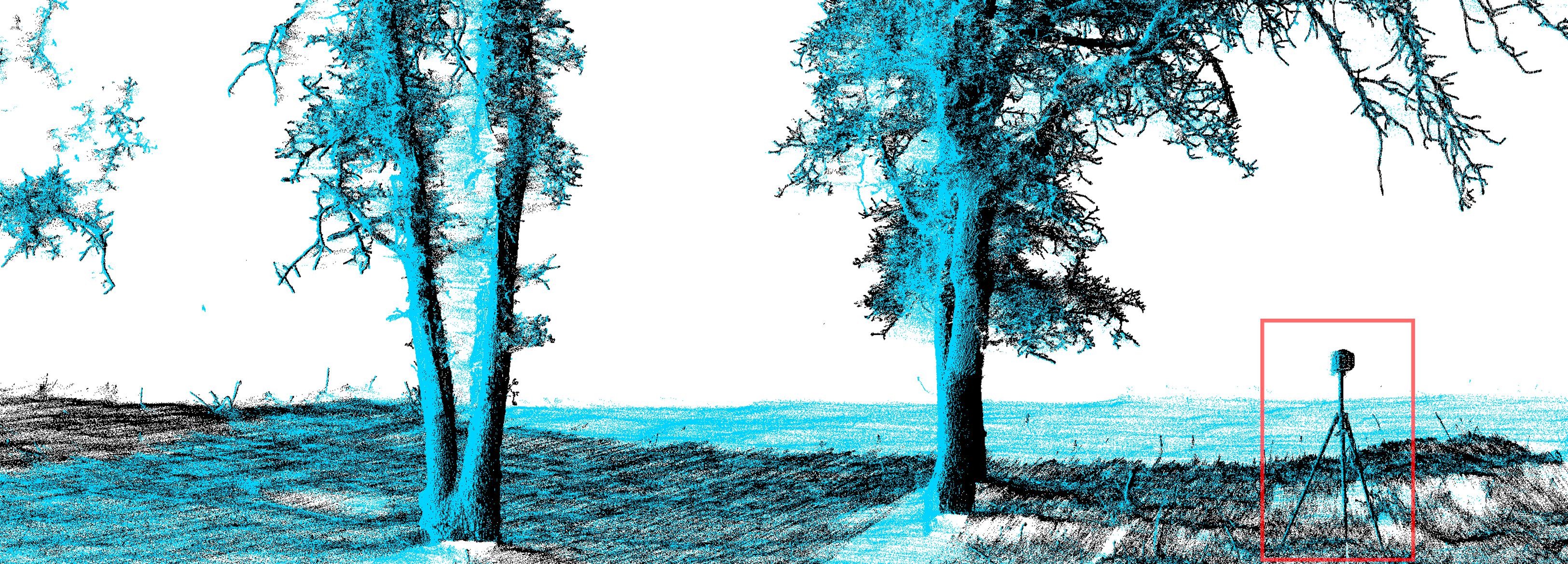
- Terrestrial laser scanning produce high-quality 3D point clouds of forests
- We can fuse multiple scans (above, one in blue and one in black) to get a more complete coverage.
- However, one needs to place registration targets on the forest floor (highlighted in red in the picture above) which is time consuming for large areas.
- We propose a parallel algorithm which uses trees as registration targets and removes the need for artificial targets.
- The paper is available here.